Newark Maps

A Collection of Newark Maps


Borders


newarkborders01.jpg

1 files, last one added on Jun 26, 2020
Album viewed 176 times

1666 - 1800


newarkmap177601.jpg

6 files, last one added on Jun 26, 2020
Album viewed 115 times

1800 - 1900


newarkmap1879.jpg

10 files, last one added on Jun 26, 2020
Album viewed 136 times

1900 - 2000


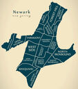
newarkmapareas.jpg

8 files, last one added on Aug 16, 2024
Album viewed 140 times


4 albums on 1 page(s)

Random files - Newark Maps - Single Page
newarkmap166602.jpg
Samuel H. Conger's 1666 Town Lots1829 viewsSouth West Section (Upper Left Quadrant)
Lot 1. The Meeting-House
Captain Treat's Extra
Left of Lot 1. John Johnson
Right of Lot 9. The Parsonage Home Lot
Lot 9. John Browne, Sr.
Lot 41. Stephen Bond
Lot 27. Zachariah Burwell
Lot 24. Ephraim Burwell
Left of Lot 24. Thomas Ludington
Lot 14. John Brooks
Lot 23. Thomas Lyon
Above Lot 14. Joseph Johnson
Above, Right of Lot 14. John Treat
Above Lot 24. John Gregory (12)
Lot 8. Henry Lyon
Lot 29. Walter's second division
Below Lot 29. Joseph Walters
Lot 16. Francis Linle (or Lindsley)
Lot 30. Robert Dalglish (or Douglas)
Below Lot 30. Samuel Camfield
Above Lot 3. Matthew Williams

North West Section (Upper Right Quadrant)
Lot 5. Lieutenant Samuel Swaine
Lot 12. Sergeant Richard Harrison
Lot 15. Edward Ball
Lot 32. John Morris, in 1688
Lot 14. John Ward Sr.
Lot 3. Matthew Camfield
Lot 2. Abraham Pierson Jr.
Lot 1. Jasper Crane
Lot 9. Thomas Pierson, Sr.
Right of Lot 9. Benjamin Baldwin
Lot 18. Thomas Huntington
Right of Lot 19. Alexander Munrow
Lot F. The Elder's Lot
Lot 10. John Ward Jr. the turner
Lot 21. Deacon Richard Laurence
Lot 19. Delivered Crane
Lot 31. Hans Albers
Lot 8. Samuel Rose
Lot G. The Miller's Lot
Above Lot 8. Samuel Dod
Above Lots 19,31. Daniel Dod
Right of Lot G. The Corn Mill

South East Section (Lower Left Quadrant)
(Plus Diagonal Row/Upper Left Quadrant)
Lot 1. Captain Robert Treat
Lot 2. Abraham Pierson
Lot 25. Robert Denison
Lot 22. Thomas Johnson
Lot 21. George Day
Lot 26. Nathaniel Wheeler
Lot 40. Joseph Riggs
Lot 28. William Camp
Lot 35. Martin Tichenor
Lot 7. Stephen Freeman
Lot 23. John Curtis
Lot 18. John Baldwin
Left of Lot 18. Thomas Staples
Lot 19. John Baldwin Jr.
Lot 6. Deacon Michael Tompkins
Lot 20. Jonathan Tomkins
Lot 34. Ephraim Pennington
Left of Lot 34. Seth Tomkins
Lot 39. The Tailor's Lot
Lot 9. Thomas Pierson Jr.
Right/Below Lot 36. Samuel Harrison
Lot 36. John Browne Jr.
Lot 12. Edward Riggs
Lot 33. Hugh Roberts

North East Section (Lower Right Quadrant)
Lot 4 (open face). Deacon Lawrence Ward
Lot 11. John Catlin
Lot 4 (closed face). Samuel Kitchell
Lot 7. Josiah Ward
Lot 10. John Rogers
Lot 13. Robert Kitchell
Lot 5. Jeremiah Pecke
Lot 2. Obadiah Bruen
Right of Lots 10,2. The Seaman's Lot
Left/Below Lot 16. Thomas Richards
Lot 16. John Harrison
Lot 20. Aaron Blatchly
Lot 11. Stephen Davis
Lot 6. Samuel Plum
Lot 17. John Crane
Lot 37. The Boatman's Lot
Lot 15. Robert Lymon
Right of Lot 15. John Davis
newarkborders01.jpg
Expanding & Contracting Borders792 viewsPhoto from "The Running Brooks" by Edward S. Rankin
newarkmap1764ballmap.jpg
1764 Ball Map of the Newark Mountain Purchase Claim1422 viewsMap from William Johnson
newarkmap1890deathrate.gif
1890 Death Rates under 5 years of age1003 views
newarkmap180603shoemakermap.jpg
Shoemaker Map 18061192 viewsFrom "Newark in the Public Schools"
newark180602published.jpg
1806 (Published)902 views
indiantrailsmap.gif
Indian Trails858 views
newarkmap1904.jpg
19041655 views
newarkmap177601.jpg
17761064 viewsSamuel H. Congar map
newarkmap166603.jpg
16661779 viewsStreets and Areas as Known Today
STREETS
1. High Street
2. Washington Street
3. Broad Street
4. Mulberry Street
5. McCarter Highway
6. Spruce Street
7. 15th Avenue (?)
8. Market Street
9. Central Avenue (?)
10. Orange Street
11. Clinton Avenue
12. Court Street (?)
13. Tichenor Street
14. Walnut Street
15. Centre Street
16. South Street (?)
17. Mulberry Place (?)

AREAS
A. Lincoln Park
B. Military Park
C. Washington Park
D. County Court House
E. The Four Corners
F. Penn. Station
G. Ironbound or Down Neck Section
H. City Hall
J. Star Ledger

Last additions - Newark Maps - Single Page
newarkmapareas.jpg
Areas59 viewsAug 16, 2024
newarkmap1916.jpg
19161152 viewsJun 26, 2020
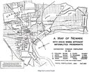
newarkmap1910nationalities.jpg
19103796 viewsNationalitiesJun 26, 2020
newarkmap1904.jpg
19041655 viewsJun 26, 2020
downtownnewark1966.jpg
19662188 viewsDowntownJun 26, 2020
northnewarkmap1900.jpg
19001602 viewsNorth Newark
Image from Lonna Doyle
Jun 26, 2020
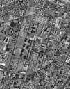
thirdwardnasa1995.jpg
19951659 viewsThird Ward (NASA photo)Jun 26, 2020
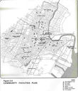
communityfacilitiesmap.jpg
Unknown Year860 viewsCommunity Facilities PlanJun 26, 2020
newarkmap1879.jpg
18791177 viewsVery Large - Click on the image.
Some browsers will limit the size of the map automatically. You can adjust this in your browser settings. You can also download the map to view the full size.
Jun 26, 2020
newarkmap1836.gif
18361156 viewsJun 26, 2020