|
|
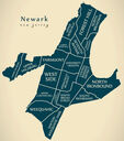
Areas749 viewsAug 16, 2024
|
|
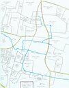
1800 Large Detailed Map2113 viewsJun 26, 2020
|
|
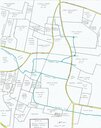
1800 Detailed Map2276 viewsThese maps were created by Charles McGrath, this is his explanation of how he created them:
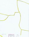
The attached are two maps of the area of Newark called Vailsburg. The detailed map is what it looked like in the 1700's and early 1800's. The other map is for cross reference and shows what the former roads as they presently exist.
The area portrayed on both maps is approximately from South Orange east to the Garden State Parkway and from South Orange Avenue south to Springfield Avenue (this area is approximately two square miles).
Long forgotten roads like "Old Road" and forgotten areas like Flaggy Swamp, Brushy Plain, Dogs Misery and North Farms (part of Camp Farms) can be seen on the detailed map.
I began doing research on the history of Vailsburg in the early 1960's. At that time there were no complete maps of Vailsburg from the 1700's and early 1800's I tried to fill this void by generating a map of Vailsburg from that period. The description of land on a deed would contain coordinates, landmarks and the names of adjacent neighbors.
Through extensive research of land deeds at the Essex County Hall of Records I became very familiar with its residents. This was essential because there were no street names or house numbers.
The map was created like someone trying to solve a jigsaw puzzle. The main difference being that the puzzle pieces also had to be made. I would make a jigsaw piece from a known deed to a common scale of 1" = 300'. This piece would be compared with countless others to find it's location on the map. As a result, after many years of research, I developed a map of Vailsburg which reflects the area from the 1700's to the early 1800's.
Each parcel of land on this map has the following information:
The name on the property is that of the grantor (owner) who sold the land to the grantee (buyer).
The year on the property is when the grantor sold it.
Directly below the year is the letter (or prefix) which indicates the Grantor book and the number represents the page in that book.
The above mentioned information was obtained from the Grantor Books at the Essex County Hall of Records. For an example look at the upper left hand portion of the Vailsburg map. The property with road frontage on the west side of the Road to Connecticut Farms (Stuyvesant Avenue) was sold by Doctor Bonnel to Jabez Baldwin in 1811 A.D. In Grantor's Book T, located on page 367. The following is a description of that parcel of land on this map as copied from the above deed:
On the northwest side of the road that leads from Captain Eleazer Hedden's to Connecticut Farms. Beginning at the southeast corner of Jonathan Lindsley's orchard at a white oak stump.
(1) N68 Degrees W 17 chains and 4 links to Nathaniel Tichenor's.
(2) S14 Degrees W 3 chains to a stake.
(3) S65 Degrees E 17 chains and 78 links to the end of a stone fence.
(4) S11 Degrees W 6 chains and 57 links to Denises Gutter.
(5) S44 Degrees E 3 chains and 90 links to a stake at the corner of
Moses Roberts.
(6) N23 Degrees E 5 chains.
(7) S68 Degrees E 6 chains and 86 links.
(8) N27 Degrees E 7 chains and 27 links.
(9) S78 Degrees E 1 chain.
(10) N26 Degrees E 1 chain and 19 links.
(11) N83 Degrees W 70 links.
(12) N21 Degrees W 2 chains.
(13) N5 Degrees E 1 chain and 54 links .
(14) N63 Degrees W 2 chains and 54 links.
(15) N78 Degrees W 2 chains and 79 links.
(16) N62 Degrees W 2 chains and 52 links.
(17) N82 Degrees W 2 chains and 78 links.
(18) S25 Degrees W 2 chains and 33 links to the beginning.
(total area = 19 acres)
Note One chain equals 100 links or 66 feet
Jun 26, 2020
|
|
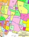
Vailsburg circa 18003711 viewsJun 26, 2020
|
|

1800 Deed2128 viewsAaron Baldwin
to
Jabez B. Baldwin
Lying in West Farms lying west of Dennis Patent
__________
Coordinates
_________
37 acres
__________
Fourteenth day of April in the twentieth year of American Independence
and in
the year of our lord Christ one thousand seven hundred and ninety six.
signed
Aaron BaldwinJun 26, 2020
|
|
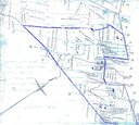
18812964 viewsMap Legend
(1) Lydia Lindsley's House
Lydia Lindsley's house was built around 1760 A.D. It was a local tradition that George Washington used it as his head quarter's during the Battle of Springfield in 1780 A.D. This house was located on Stuyvesant Avenue near Silver Street. It faced east and was 300' from the Elizabeth River (Brookdale Avenue). Around 1900 A.D. a Mr. Weeder owned this house. He was the old lamp lighter who traveled by horse and wagon throughout the streets of Vailsburg tending the the gaslights. It was torn down in 1965 A.D. and was replaced by a small apartment complex.
In the late 1940's as a young newspaper boy for the Newark Star Ledger I visited this house many times. It was a one story building and the main entrance was around 6 feet above Stuyvesant Avenue. The living room floor was made of 6" wide wooden planks. The kitchen had a large brick oven (used for baking) in it's fireplace.
When it was torn down 37 years ago I tried to salvage portions of it. I retrieved two large beams and a portion of the brick oven. I have a portions of the pegged beams (tendon and mortise) with roman numerals carved on them. The roman numerals were evidently used to identify each beam. I never seen this done before because the beams were made on site. There would be no need to identify them during construction. It's my contention that this house may have been moved to its present location in the early 1700's.
(2) The first school in Vailsburg
The first school in Vailsburg was a one room school house built in 1850 A.D. when this area was still part of South Orange Township. It was called Columbia School. It was located on South Orange Avenue near Boylan Street Pool. The building was used in later years as Charlie's Bike Shop. The building next store to it was ABCO Auto Parts Store.
Another school was built on Alexander Street in 1895 A.D. This building was much larger and could accommodate more students ; however, it soon proved to be to small for a growing population. It was replaced by the present day Alexander Street School. The older building was moved to 128 Brookdale Avenue where it now serves as a two family house.
(3) The First Horse Car Line To Vailsburg
Shortly after the Civil War, Dr. Vail and several of his friends raised $50,000.00 and constructed a a horse car line (a trolley car pulled by a horse) on South Orange Avenue. The Car ran from Boston Street (three blocks up from High Street) to Munn Avenue. Dr. Vail was superintendent of construction and conductor on its maiden trip from Newark. The fair at that time was six cents.
While the Orange Horse Car Railroad was a progressive adventure it turned out to be a financial failure because it was ahead of it's time. James Boylan ( source of the name for Boylan Street ) took over the line and also failed.
It wasn't until John Radel bought it in 1877 A.D. that it proved to be a great success. By then the crowds from the lower portions of Newark had discovered Scheutzen Park (Vailsburg Park) and used the line to visit it frequently. This line was also primarily responsible for the rapid growth and development of Vailsburg. It provided a means of transportation for those who wanted to work in Newark and live in the suburbs. The original horse car stables were still standing in the late 60's. They were opposite Brookwood Street in the rear of a gas station.
(4) Scheutzen Park
Scheutzen Park or Shooting Park was a favorite picnic and outing spot for the people of other portions of Newark. Scheutzen Park which later became Electric Park was one of New Jersey's first and most important amusement parks. Electric Park was located on the present site of Vailsburg Park
(5) Washington Stayed Here
There is a tradition that Washington and some of his men stayed here during the Revolution. In 1797 A.D. (Battle of Springfield). Aaron Baldwin owned this property and willed it to his son Joel. The map at that time, dated September 7,1797 A.D., showed the old house on South Orange Avenue, which at that time made a north -east turn near what is now Munn avenue. The road was much higher than it is now. South Orange Avenue is referred to as "The Road "and Munn Avenue as " the road running from the main road to North Orange ."
In my research I came across this house many times. This area was also called "Dogs Misery ". The house was probably built prior to 1717 A.D. Aaron Baldwin owned slaves ( slaves in Vailsburg). Unfortunately this house was demolished in circa 1960 and replaced by Kravet's Pharmacy.
(6) Dr. Malcolm Vail
Vailsburg was named after Dr. Malcolm Vail. I believe he was a medical doctor. He was the first mayor of the Borough of Vailsburg and he lived on Vail Street near Kenmore Avenue. The area we know as Vailsburg was once part of Clinton Township and later it became part of South Orange Township. From 1895 -1905 A.D. this area became the Borough of Vailsburg. In 1905 A.D. it became part of Newark.
Joshua O. Baldwin's homestead
In 1881 Mr. Albert Smith who later became the Mayor of Vailsburg owned the property on the southeast corner of South Orange and Sandford Avenues. This was the homestead of Joshua O. Baldwin's. This house was built in the latter portion of the 1700's . Around 1900 A.D. It was known as the Raub Homestead. It's wide front porch and broad lawn containing a brook (branch of the Elizabeth River) faced South Orange Avenue. This home was the scene of many annual Fourth of July celebrations. These took place while Vailsburg was a independent borough (1895-1905 A.D. ). It was later remodeled although most of the old time charm remained. I'm sure many of us remember it as Burn's Funeral Home. Today it's a private residence?
Jun 26, 2020
|
|
1800 Cross Reference1823 viewsJun 26, 2020
|
|

19042494 viewsAlong So. Orange Ave. from Isabella to Clinton Street, showing Alexander Street School, German Zion Church & West End Hose Co. #2Jun 26, 2020
|
|
Newark 1666 - 17133391 viewsJun 26, 2020
|
|

1700 Lyons Farm and Woodruff Farm (updated 8/1/06)3784 viewsJun 26, 2020
|
|
1670 Newark, lot's of the first settlers. (partial map)2590 viewsJun 26, 2020
|
|

18362522 viewsJun 26, 2020
|
|
1700 Lyons Farm and Woodruff Farm Narrative2805 viewsJun 26, 2020
|
|

Newark Mountain 16962995 viewsJun 26, 2020
|
|
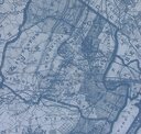
1872 Essex County2408 viewsJun 26, 2020
|
|
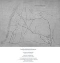
Newark Township ~17101924 viewsJun 26, 2020
|
|
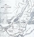
East Jersey (including Newark, Elizabeth, Woodbridge & Piscataway Townships)1993 viewsJun 26, 2020
|
|

1747 Newark and Vicinity2026 viewsJun 26, 2020
|
|

1850 Newark, west to first mountain2090 viewsJun 26, 2020
|
|
1891 Essex County topographical map2122 viewsJun 26, 2020
|
|

1614 Area map of North Eastern New Jersey1844 viewsJun 26, 2020
|
|

Tillinghast Street1464 viewsJun 26, 2020
|
|

Rose Street1450 viewsJun 26, 2020
|
|

Rose Terrace1448 viewsJun 26, 2020
|
|

South Tenth Street1490 viewsJun 26, 2020
|
|

Lyons Avenue1548 viewsJun 26, 2020
|
|

Nye Avenue1750 viewsJun 26, 2020
|
|

Edmunds Place1410 viewsJun 26, 2020
|
|

Clinton Avenue1816 viewsJun 26, 2020
|
|

Edwin Place1655 viewsJun 26, 2020
|
|

Clinton Avenue1450 viewsJun 26, 2020
|
|

Clinton Avenue2089 viewsJun 26, 2020
|
|

Bragaw Avenue1412 viewsJun 26, 2020
|
|

Bragaw Avenue1388 viewsJun 26, 2020
|
|

Waverly Avenue1688 viewsJun 26, 2020
|
|

Bloomfield Avenue1606 viewsJun 26, 2020
|
|

West Side Park1453 viewsJun 26, 2020
|
|

West Side Park1402 viewsJun 26, 2020
|
|

Springfield Avenue1615 viewsJun 26, 2020
|
|

Ashland Street1383 viewsJun 26, 2020
|
|

Woodland Avenue1442 viewsJun 26, 2020
|
|

German Street1412 viewsJun 26, 2020
|
|

Lister Street1574 viewsJun 26, 2020
|
|

Manufacturers Place1603 viewsJun 26, 2020
|
|

Horatio Street1572 viewsJun 26, 2020
|
|

Emma Street1438 viewsJun 26, 2020
|
|

Lister Street1445 viewsJun 26, 2020
|
|

Cornelia Street1585 viewsJun 26, 2020
|
|

Chapel Street1801 viewsJun 26, 2020
|
|

Brown Street1442 viewsJun 26, 2020
|
|

Chapel Street1784 viewsJun 26, 2020
|
|

Blanchard Street1488 viewsJun 26, 2020
|
|

Berlin Street1458 viewsJun 26, 2020
|
|

Plank Road1546 viewsJun 26, 2020
|
|

Barbara Street1525 viewsJun 26, 2020
|
|

Albert Avenue1445 viewsJun 26, 2020
|
|

New Street1505 viewsJun 26, 2020
|
|

Jefferson Street1365 viewsJun 26, 2020
|
|

Harper Street1430 viewsJun 26, 2020
|
|

Garden Street1369 viewsJun 26, 2020
|
|

Emmet Street1323 viewsJun 26, 2020
|
|

Emmet Street1658 viewsJun 26, 2020
|
|

Dawson Street1434 viewsJun 26, 2020
|
|

Backus Street1278 viewsJun 26, 2020
|
|

Clover Street1357 viewsJun 26, 2020
|
|

Avenue D1393 viewsJun 26, 2020
|
|

Wheeler Point Road1339 viewsJun 26, 2020
|
|

Wheeler Point Road1399 viewsJun 26, 2020
|
|

Wheeler Point Road1395 viewsJun 26, 2020
|
|

Vesey Street1477 viewsJun 26, 2020
|
|

VanBuren Street1400 viewsJun 26, 2020
|
|

Parkhurst Street1314 viewsJun 26, 2020
|
|

Lum Street1389 viewsJun 26, 2020
|
|

Jefferson Street1409 viewsJun 26, 2020
|
|

Murray Street1324 viewsJun 26, 2020
|
|

Renner Avenue1458 viewsJun 26, 2020
|
|

Stanton Street1407 viewsJun 26, 2020
|
|

Pennsylvania Avenue1419 viewsJun 26, 2020
|
|

Osborne Terrace1352 viewsJun 26, 2020
|
|

Peddie Street1431 viewsJun 26, 2020
|
|

Noble Street1428 viewsJun 26, 2020
|
|

Meadow Road1337 viewsJun 26, 2020
|
|

Marie Place1383 viewsJun 26, 2020
|
|

Meadow Road1479 viewsJun 26, 2020
|
|

Livingston Street1533 viewsJun 26, 2020
|
|

Lyons Avenue1376 viewsJun 26, 2020
|
|

King Street1421 viewsJun 26, 2020
|
|

Keer Avenue1438 viewsJun 26, 2020
|
|

Frelinghuysen Avenue1496 viewsJun 26, 2020
|
|

Earl Street1367 viewsJun 26, 2020
|
|

Conklin Avenue1425 viewsJun 26, 2020
|
|

Chancellor Avenue1757 viewsJun 26, 2020
|
|

Belmont Avenue1400 viewsJun 26, 2020
|
|

Chancellor Avenue1405 viewsJun 26, 2020
|
|

Wilbur Avenue1327 viewsJun 26, 2020
|
|

Wright Street1333 viewsJun 26, 2020
|
|

Vassar Avenue1376 viewsJun 26, 2020
|
|

Treadwell Street1498 viewsJun 26, 2020
|
|

VanWagenen Street1494 viewsJun 26, 2020
|
|

Warren Street1668 viewsJun 26, 2020
|
|
|
|
